Unveiling Earth’s Secrets: NASA and ISRO’s Groundbreaking NISAR Mission
Our planet is a dynamic and ever-changing entity, and understanding its intricate processes is crucial for our future. To achieve this, two of the world’s leading space agencies, NASA and ISRO (Indian Space Research Organisation), have joined forces for an ambitious endeavor: the NASA-ISRO Synthetic Aperture Radar (NISAR) satellite mission. This collaboration represents a significant leap forward in our ability to observe and study Earth from space, promising to unlock invaluable insights into our planet’s complex systems.
What is NISAR and Why is it Important?
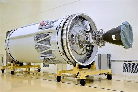
NISAR is not just another satellite; it’s a sophisticated Earth-observing mission designed to provide unprecedented views of our planet’s surface. Its primary instrument is a powerful Synthetic Aperture Radar (SAR) that can “see” through clouds and in darkness, allowing for continuous monitoring regardless of weather conditions. This capability is vital for understanding phenomena that are often obscured from optical view. The mission’s core objective is to map Earth’s land and ice surfaces in high resolution, providing data that will help scientists understand changes in ecosystems, natural hazards, and the effects of climate change.
The Power of Dual-Frequency Radar
A key innovation of NISAR lies in its use of two different radar frequencies: L-band and S-band. The L-band radar, provided by NASA, can penetrate deeper into vegetation and soil, offering insights into forest biomass, soil moisture, and underground water resources. The S-band radar, contributed by ISRO, is more sensitive to surface features and is excellent for observing changes in glaciers, ice sheets, and urban infrastructure. By combining data from both frequencies, NISAR will offer a more comprehensive and detailed picture of Earth’s surface than ever before.
Key Scientific Objectives of NISAR
The NISAR mission is poised to address several critical scientific questions. It aims to:
Monitor Earth’s changing land surfaces: This includes tracking deforestation, land degradation, and the impact of human activities on natural landscapes.
Study the dynamics of ice sheets and glaciers: Understanding the melting rates of polar ice is crucial for predicting sea-level rise.
Map soil moisture and its role in climate: Accurate soil moisture data is essential for agricultural planning and understanding drought patterns.
Observe natural hazards: NISAR will provide valuable data for monitoring and understanding earthquakes, volcanic activity, and landslides, aiding in disaster preparedness and response.
Track changes in ecosystems: The mission will help scientists understand how forests and other ecosystems are responding to climate change and other environmental pressures.
A Collaborative Triumph: NASA and ISRO at the Forefront
The NISAR mission is a testament to the power of international collaboration in scientific exploration. NASA and ISRO, two of the world’s most advanced space agencies, have pooled their expertise, resources, and technological capabilities to bring this ambitious project to fruition. This partnership not only strengthens scientific understanding but also fosters goodwill and shared progress on a global scale. The successful launch and operation of NISAR will undoubtedly mark a new era in Earth observation and a significant achievement for both nations.
Looking Ahead: The Future of Earth Observation
The data generated by NISAR will be made available to scientists worldwide, fostering a global effort to understand and protect our planet. As we face the challenges of a changing climate and increasing environmental pressures, missions like NISAR are indispensable tools. They provide the critical information needed to make informed decisions, develop effective mitigation strategies, and ultimately, ensure a sustainable future for generations to come. The NISAR mission is not just about observing Earth; it’s about understanding it, protecting it, and securing our place within its delicate balance.